
Water
- Apr 6, 2015
- 50 min read
Introduction This message is much longer than the first three. It is not more important than those which precede it, but it is more complex. To understand Mother Earth’s message to us about water in her Los Angeles region, we need to know something of the history which she and her creation here has suffered since 1771. She has not told me this history – she does not speak to me in numbers, nor does she use our names, or languages for that matter (see The Beginning of the First Step) – but she has moved me to learn the essentials and to recount them to you. From this, if you do not know it already, I hope you will be able to see how onerous are the dams in place today; and also that their removal is only the beginning. Our assault upon her is deeply rooted, even here, where it began only 234 years ago. Seeing some specifics of its character, especially with regard to our treatment of her water, is a necessary part of our choosing to break from it. It is necessary as well to understand why she might tolerate it no longer. In Los Angeles, water is the first key. It is crucial to life across the whole surface of Mother Earth. It is particularly important in places like L.A., where the average annual rainfall outside the mountains varies from ten to fifteen inches, usually an indication of near-desert conditions. Understanding Mother Earth’s water in L.A. actually requires a grasp of five realities:
the condition of natural water systems before the arrival of the Europeans and their descendants
the oppressive, disastrous pillaging of these systems by European/American settlement and economic activity
the 20th century imprisonment of the failing natural systems with artificial flood control devices
the theft of extra-region water
Mother Earth’s conclusion Before European Occupation Although there is evidence of fairly dramatic climate change in Mother Earth’s Los Angeles over the last thousand years, patterns since 1700, including the decades prior to and at the beginning of European settlement, appear to have been relatively stable [Extreme Late Holocene Climate Change in Southern California]. Recent rainfall levels are therefore likely to be similar to those prevailing in the last part of the 1700s; that is, what we receive and record today seems to be pretty much what fell then. Rainfall in L.A. is slightly lower at the coast than only a few miles inland. The Western Regional Climate Center reports that Santa Monica Pier receives an average 13 inches per year, while downtown Los Angeles, almost sixteen miles east, is some 15% wetter, at 15 inches per year. Further inland becomes more desert-like: Yorba Linda, 36 miles from the coast, receives 14 inches per year, while Riverside, sixty miles inland but still west of the San Jacinto Mountains, averages only 10 inches. Such rainfall levels do not produce much water, and that which falls tends to run off quickly rather than soaking into the soil and underground aquifers. L.A.’s reputation as a naturally semi-arid region would be justified were this the whole story. It is not. Before the destruction caused by Europeans and their heirs, Los Angeles had abundant surface and underground water. This was made possible by the mountains. Precipitation in the San Gabriel, San Bernardino, and San Jacinto mountains is much higher than in the adjacent hills, valleys and plains. Even foothill communities show evidence of this effect. Tujunga, in the western foothills of the San Gabriels, averaged, over a recent twenty year period, 21 inches annually. Pomona Fairplex, in the valley just below Old Baldy, receives 17 inches per year. In the mountains proper, precipitation is directly related to altitude. Mount Wilson, at 5,700 ft. in the San Gabriels has a recorded annual rainfall/snowfall equivalent of 36 inches. Lake Arrowhead, at 5000 ft. in the San Bernardino Mountains, receives 40 inches. Annual averages in the San Jacintos are somewhat less, but Idyllwild, at around 5,300 ft., averages 26 inches. Systematic records at higher elevations, above 7,000 ft., are not readily available, but these areas could easily receive the equivalent of (rain and snow together) 50 inches or more in an average year. Furthermore, averages don’t tell us about extraordinary events. According to the National Climatic Data Center, “The maximum intensity of precipitation for periods of 12 hours or longer which might be expected at intervals of 10 to 100 years is greater in portions of the San Gabriel and San Bernardino Mountains in southern California than anywhere else in the continental United States.” Jim Goodridge, former California State Climatologist, has provided detailed data about this exceptional rainfall pattern. Over the 127 years 1871-1998, there have been eight recorded occasions in which more than 20 inches fell in a calendar day in these mountains, the highest being at the Hoegees R 60 gauge, in the Arroyo Seco area of the San Gabriels, which measured 26.12 inches of rainfall on Jan. 22, 1943. During this same 127 years, there were 31 incidents of recorded rainfall between 15 and 20 inches in a single day, and well over 100 incidents of rainfall between 10 and 15 inches. Such remarkable local events almost certainly have also occurred where no rain gauges were present, with the result that the actual amounts of precipation flowing into the upper reaches of Los Angeles rivers may be considerably higher than records indicate. While none of this is enough to produce true rainforests in the San Gabriels or San Bernardinos, it is evidence of an abundance of water falling in the mountains. Until the late 1770s, before European disruptions, it either fed the high country forests, moved underground into aquifers at lower elevations, or flowed into streams and rivers which delivered the water to the southward valleys (a small percentage flowed northward, into the high desert). The consequence for the valleys and plains is described by William McCawley (for a complete reference, see the message from Mother Earth titled Wildness).

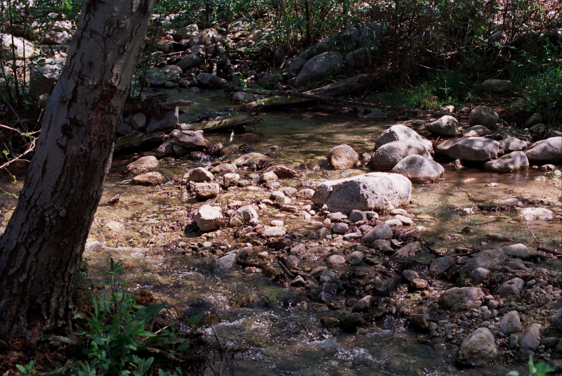
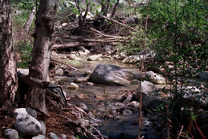
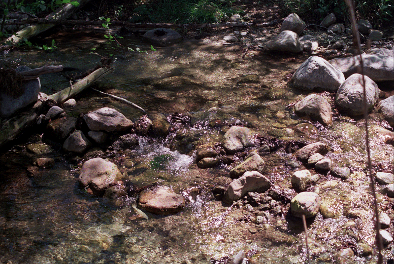
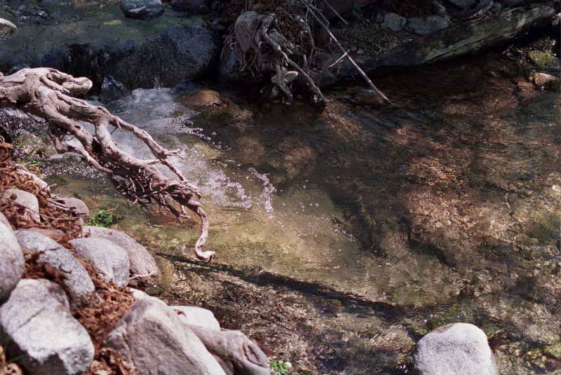
“During Gabrielino times, the land was well-watered by three major river systems and numerous streams and tributaries, many of which ran throughout the year. In addition, prior to cattle and sheep ranching there was much less runoff, which resulted in a higher water table and more ground water.”[McCawley, p. 24] For instance, “…the confluence of the Rio Hondo and San Gabriel rivers once formed a great marshland that bordered the northern slopes of the Puente Hills.”[p. 43] “The [Los Angeles] plain is traversed by a number of important watercourses, including the Los Angeles, Rio Hondo, San Gabriel and Santa Ana rivers. Marshlands fed by fresh or salt water also once covered many portions of the countryside.”[p. 55] The first Spanish land expedition to the region forded the Santa Ana River on July 28, 1769, in the middle of the dry season, a mile or so southwest of Santa Ana Canyon. Father Crespí, traveling with the expedition, wrote of the Santa Ana that day as “a river which has a bed of running water ten varas wide [about 27 feet…] and half a vara [about 16 inches] deep…The bed of the river is overgrown with sycamores, alders, willows, and other trees….”[p. 60] McCawley also comments, “An important freshwater spring once flowed near the base of the hill [in what is now Los Alamitos] and watered an extensive forest of cottonwood trees…” and “…extensive marshlands once existed near the mouth of Ballona Creek in the area now known as Playa del Rey.”[p. 61] He also notes that, “The coastal region between the present cities of Long Beach and Huntington Beach once largely consisted of low-lying marshlands subject to flooding by the Santa Ana River.” [p. 71] In his thorough history of the Los Angeles River over the last 250 years, The Los Angeles River: Its Life, Death, and Possible Rebirth, Blake Gumprecht devotes an entire chapter to the river and its watershed prior to the founding of the Spanish missions. He comments, “Three centuries ago, the river meandered this way and that through a dense forest of willow and sycamore, elderberry and wild grape. Its overflow filled vast marshlands that were home to myriad waterfowl and small animals. Steelhead trout spawned in the river, and grizzly bear roamed its shores in search of food.”[p. 2] “…before settlement by the Spanish…the river flowed when and where it wanted…. It did not always empty into San Pedro Bay at Long Beach, as it does today. Sometimes it meandered west across the coastal plain, flowing into Santa Monica Bay along the present course of Ballona Creek. “Much of the river’s waters never reached the sea, instead spreading over the countryside and joining the springs flowing from surrounding hills to form vast marshes, shallow lakes, and small ponds…. Great oak trees lined the stream course in the San Fernando Valley…. The [Los Angeles coastal] plain along the river, one of [the first European visitors] wrote, was “so green and lush it seems as though it has been planted.”[p. 9] More generally, Gumprecht adds, “The waters of the Los Angeles, San Gabriel, and Santa Ana Rivers often mingled on the coastal plain in times of flood…. Their braided channels once spread over wide areas, and their courses shifted dramatically over time. The Los Angeles River sometimes flowed south, sometimes west. The San Gabriel River once emptied into the ocean at San Pedro Bay, along a course later occupied by the Los Angeles River. The Santa Ana River also repeatedly changed its path to the ocean.”[pp. 9-10] Gumprecht’s fairly detailed account of the resulting plant and animal life includes the following: “Many modern-day observers often incorrectly assume that the Los Angeles Basin was a nearly treeless plain in its natural state; in fact, large areas of the lowlands seem to have been covered by a floodplain forest…. Cottonwoods and several species of willows were thick along the stream courses and amid the marshes, growing to heights of forty to fifty feet. Sycamores were also present, though less abundant…. Clumps of alder, hackberry, and shrubs formed a dense undergrowth beneath the trees of the willow-cottonwood forest. Masses of thorny California rose grew wild. Native grapes and other vines wound around tree branches and through the shrubs. Briars, brambles, and California blackberries were common."[p. 20] Of the Los Angeles River in particular (though his observations almost certainly apply to the San Gabriel and lower reaches of the Santa Ana as well), he writes, “Wildlife was abundant all along the river’s course. Antelope lived near the river in what is today Griffith Park…. Coyotes, gray fox, and mountain lions also roamed widely…. Hawks and condors hunted all along the river, while myriad other bird species…inhabited the willow groves that flourished along its course. Muskrats…fed on the tules and cattails that grew in the marshes and sloughs. Swans, ducks, and geese swam nearby. Turtles inhabited the small ponds near the river’s beginning in Encino, and the [San Fernando Valley] native grasses were home to gophers, badgers, shrews, and moles.”[p. 25] Even though the San Fernando Valley was hotter and drier than the basin further south, on the ocean side of the Santa Monica Mountains, it still had abundant water flowing out of the western San Gabriels. Most of this flow, however, settled through porous soils into great underground aquifers, leaving less surface water. Gumprecht describes the result “…as a huge bowl filled with water that has been tipped slightly [southward], causing its contents to overflow. That overflow created the Los Angeles River.”[p.14] As a consequence, oak trees, which like water but don’t like to stand too near it on the surface, “…were so abundant …that the first Spanish visitors to the area named the valley Santa Catalina de Bononia de los Encinos (encino is Spanish for 'live oak'). The residential community that later grew up around the site where the Spaniards camped is still known as Encino. Oak woodland occupied the drier sites, interspersed with native prairie, squaw bush, and poison oak. Grasses and wildflowers carpeted the valley floor. Cactus, sage, other small shrubs, and the occasional willow tree interrupted the extensive grasslands. Great valley oaks were scattered throughout the lowlands.”[pp. 24-25] Oaks seem also to have been abundant in the Los Angeles Basin and the valleys just south of the San Gabriels, in areas above the flood plains, marshes and sloughs. Some of Gumprecht’s detailed conclusions about vegetation and wildlife in Mother Earth’s Los Angeles may be speculative; what is clear, however, is that there was a rich ecology based upon a reliable and generous supply of water from the mountains. The Gabrielino/Tongva thrived in this favored region, without agriculture. Their staple food was acorns, but their diet was given variety by numerous other plants and animals, including for those living at or near the coast, ocean fish and other sea life. Their vibrant and culturally diverse communities would have been impossible on fifteen inches of rainfall a year. They were crushed not only by the direct social oppression of the Spaniards and the Americans. The water upon which they and the other creatures of Mother Earth’s Los Angeles depended was taken away. Mother Earth will have it back; but first, how it was taken.

The Oppression
First Assaults
The Spaniards’ first settlements in the region of Los Angeles were a mission and a pueblo (village). The Mission San Gabriel was established at the Rio Hondo River near the Whittier Narrows in 1771, and moved some three years later to its present location in San Gabriel, closer to the mountains.[McCawley, p.190] El Pueblo de la Reina de Los Angeles was founded in 1781, the beginning of what is now downtown Los Angeles.[Gumprecht, p. 43]
Clearing land and constructing buildings of European design was the first task to which the mission and later the pueblo set themselves. Clearing agricultural land and digging irrigation ditches was the second, following closely on the heels of the first. Based firmly on the principles of domination, control, and plunder of natural systems which lay (as it does today) at the heart of European-derived culture, both of these activities caused a greater change to the land and water, in the areas affected, than the whole of Gabrielino/Tongva, Serrano, and Cahuilla life over the many preceding centuries of their presence in Mother Earth’s L.A.
Trees were cut down, at first nearby, and later in the mountains to the north. Some of these were used in construction of the roofs and other parts of the adobe buildings, some as firewood, while others fell to the demands of contemporary agriculture, as did the other plants living naturally in the earth and wetlands. Lumbering to build the burgeoning lowland communities of L.A. in the 19th century was even more extensive and damaging in the San Bernardino Mountains than in the San Gabriels, wiping out most of the original high mountain forests of the San Bernardinos .[see John W. Robinson, The San Bernardinos, Chapter 5]
Initially, native people, either conscripted or hired for minimal pay, did most of the work. As later reported by one Gabrielino/Tongva informant, “…at various canyons along the [San Gabriel] mountains, pines were obtained for the mission. Pines formerly grew further down the mountain…but have been cut. The pines were carried in the carretas [carts], but the Indians being so numerous some Indians were employed to bring them on foot, such a bringer being required to make two trips from San Gabriel to the mountains and back in one day, each trip returning with a [small] pine timber…on his shoulder. They gave azotes [lashes] to the bringers who did not complete their two trips in one day….”[McCawley, p. 192]
Gumprecht observes, “The original colonists [of the pueblo] have been widely characterized as lazy. Two early mission priests commented in 1796, in fact, that “whatever is effected in those pueblos is due more to the gentile Indian of the neighboring rancherias than to the settlers. It is the hired Indian who plows, sows, harvests, in a word does nearly everything. The Indian for his labor is given his meals and a blanket.”[p. 46] He also notes that “Indians were used to maintain the water ditches. In 1836, after receiving complaints that the volume of water in the Zanja Madre [the main irrigation ditch supplying water to the pueblo from the Los Angeles River] was no longer sufficient, the town government ordered that all drunken Indians be arrested and required to work on the ditches until the amount of water they carried increased.”[Gumprecht, pp. 46-47]
In addition to the distress and even death of the forced native laborers, as well as that of the displaced wild animals and plants (yes, Mother Earth tells me that plants do feel equivalents of pain, distress and shock), the effect of these changes, which spread as the settlements grew and others were formed, was two-fold.
The reduction of the forest and woodland cover in the mountains, valleys and plains, both trees and undergrowth, greatly increased the potential for lowland flooding from mountain rainfall and snowmelt, damaging and lowering dramatically the water-holding power of the lowlands. Secondly, irrigation reduced the flow of the source rivers and streams, draining the marshes and sloughs, even when an expanding agriculture did not do so directly. Added to this, the irrigation ditches, unprotected by overhanging trees and shrub, lost much more water to evaporation than the natural surface water they were replacing, further reducing the overall presence of water in the region.
During the 1800s, in the foothills and mountains proper, expanding human settlement and cattle and sheep grazing, especially in the San Bernardinos, also contributed to the decline in lowland water.[The San Bernardinos, Chapter 10] Now much more technically complex, with urban concrete parking lots, roads, storm drains, and buildings replacing the ranches and farmland of the late 18th and 19th centuries, the devastation continues apace in the 21st century lowlands of Los Angeles. Wherever the current multitude of sprinklers does not reach, the L.A. lowlands and foothills are a brown, semi-arid land. Few significant marshlands remain; a part of one, at the mouth of Ballona Creek, has recently been rescued, after a long struggle, from real estate developers (see the Ballona Wetlands Land Trust).
Gold Fever
On March 9, 1842, the first official gold rush in the San Gabriel Mountains, and the first in California, began [The San Gabriels, p. 17 (for a complete reference, see the message from Mother Earth titled Wildness)]. This discovery, of placer gold, was in a western San Gabriel canyon, later named Placerita Canyon. A similar discovery was made the following year in nearby Sa Feliciano Canyon.
The technology the Spaniards used to extract this surface gold dust was simple, washing gold bearing gravel in a shallow wooden bowl, but the mining camps they formed and the trails they wore bringing out the gold clearly diminished the natural water storage capacity of the area. Once the Americans took control, in 1847, matters took a decided turn for the worse.
The story of American mining in the San Gabriels is intricate and long, and Robinson tells a good deal of it in three separate chapters. Where possible, the mining was extended to include silver and copper, although gold remained the primary interest. Discoveries were made and mines developed throughout the mountains. For instance, Americans found gold on the East Fork of the San Gabriel River, in the eastern San Gabriels near Old Baldy and Mount Baden-Powell, around 1854 (the Mission San Gabriel may have mined gold there much earlier), and this resulted in a pursuit of gold on the East Fork for more than a hundred years. According to Robinson, the East Fork gold has been “…panned, sluiced, long tommed, hydraulicked and blasted out of the canyon gravels and hillsides.”[p. 41] In 1859 a mining town even sprang up on the East Fork, known as Eldoradoville and offering among other conveniences three stores and a half-dozen saloons.[pp.42-43]. Mother Earth destroyed the town and much of the surrounding mining activity in a great flood down the East Fork on Jan. 18, 1862. According to Robinson, mining in San Gabriel Canyon after the flood “…never again approached the scale of the 1859-1862 period.”[p. 43]
Among the mining techniques employed in the mountains, hydraulic mining was the most devastating, tearing vegetation and even bare rock from mountainsides by means of voluminous high pressure streams of water, but the ancillary construction and transportation were almost equally damaging to the natural environment. To illustrate, an article on the East Fork from the Southern Vineyard on August 23, 1859 informs its readers that “Among the most extensive mining operations upon the river are those of the Little Falls Co. and McClure & Co. The former have constructed a flume several hundred feet in length, and of sufficient capacity to carry the waters of the San Gabriel at a high stage. All the modern facilities have been brought into requisition, vis [sic] waterwheels, pumps, derricks, railroads, etc., all of which they have accomplished by their industry in the short space of three months…The latter of the parties named above are engaged in putting up a hydraulic pump for the purpose of washing a hill claim.”[p. 42]
Robinson observes that “Almost every canyon in the [San Gabriel] range felt the trod of miners’ boots and the thud of their tools. Streambeds were turned upside down, tunnels were bored, hillsides were washed away, and all manner of mining equipment was hauled into the canyons and up precipitous slopes. It is not an overstatement to say that the entire San Gabriel Mountains were turned into a vast prospecting ground. The scars of many of these ventures are still visible today.”[p. 45] Even when the mines were tunneling underground, as many did, the impact on the forest above was severe. The tunnels used timber. For example, “6500 foot Mount Gleason looms high over the western flank of Soledad Canyon. Its wooded slopes and broad summit were readily visible to the canyon miners. George Gleason, superintendent of the Eureka Mine, needed timber to shore up his tunnels and figured the pines he could see atop the high mountain would suffice. Accordingly, in 1869, Gleason and his miners began hacking out a rough roadway up the mountainside. A sawmill was erected near the summit and the cut timber was hauled down to the mines. This proved a harrowing operation because of the road’s steepness. Logs were fastened behind the lumber wagons, pulled by eight-mule teams, to slow the descent.”[p. 49].
Another instance of the ill-considered passion with which gold was pursued in the mountains was the Santa Anita Mining Company, located in Big Santa Anita Canyon. The company installed hydraulic works “…to mine the gulches and hillsides above the streambed, and a ditch four miles long, winding around the hills from up-canyon, was excavated.” The hydraulic works were described as “on the most extensive scale.” The rewards from the consequent destruction were, it seems, inadequate. The Santa Anita Mining Company stopped work in 1861; its former location in the canyon is now partly submerged under the Santa Anita Dam reservoir.[p. 53]
The first reported gold strike in the San Bernardino Mountains was in 1855, and the subsequent influx of miners had a similar impact to that in the San Gabriels, with one important exception. Hydraulic mining “…saw limited use in the San Bernardinos because of a paucity of running water in the mining areas. Neither Holcomb Creek nor Bear Creek [where much of the mining took place] flowed with enough volume to support…large-scale hydraulic mining….”[The San Bernardinos, p. 58]. Significant mining continued in the San Bernardinos well into the 20th century.
Fire
Wherever vegetation gathers and/or active volcanoes appear on Mother Earth, fires follow, even in rain forests. This is true in Mother Earth’s L.A. Wherever they have dwelt and so long as they have had some control over fire, human beings have always been one of the initiators of these wildfires, by accident or plan, in L.A. as elsewhere. The Gabrielino/Tongva are said to have “…sometimes hunted rabbits by setting fire to the brush and driving the animals into nets.”[McCawley, p. 115] The Chumash, their neighbors in the western Santa Monica Mountains, are claimed to have”…practiced burning to control the spread of chaparral, maintain open grasslands and increase the availability of wild seeds from plants that sprout following a fire.”[McCawley, p. 116]
Whatever the frequency and extent of the use of wildfire among the pre-European L.A. human communities, the newly-arrived European-Americans raised wildfire making to a qualitatively different level. In the second half of the 19th century, cattle and sheep herders used wildfires as a standard land-management technique in the San Gabriel and San Bernardino Mountains. As asserted for the Chumash in the smaller and dryer Santa Monicas, the aim was to replace brush from the lower canyons and mountain interiors with post-burn naturally occurring, though impermanent, grasslands. This was particularly wasteful in the San Gabriels and San Bernardinos, since in these larger and generally more precipitous mountains much of the land was too steep for grazing, and, depending upon the soil and microclimate, grasses would not always flourish after the burn. Further, destroying the more deeply rooted chaparral and especially the upland forests lowered the critical water bearing capacity of these relatively high rainfall areas. The scale of these fires was, moreover, greatly amplified by the previous assault of loggers and miners, which began over 100 years earlier, on the fire-resistant old growth forests and woodlands.
For instance, “In 1878, two Texas cattlemen set brush fires in Soledad Canyon for the purpose of producing more food for their livestock. Before the conflagration spent itself several weeks later, much of the chaparral cover at the western end of the San Gabriels had been burned off.” In that same year, “…herdsmen on the Verdugo Ranch started a fire that burned over the Verdugo Hills into the south flank of the San Gabriels, reaching as far as the upper reaches of Big Tujunga Canyon.” [The San Gabriels, p. 97]
Again in 1878, a more modest attempt at brush clearing nevertheless had similar results. “The Los Angeles Herald of September 12, 1878 reported, “Yesterday evening and the night before a tongue of fire could be seen licking its way up the San Gabriel range of mountains… The scene of conflagration seemed not to be over a mile distant, while it was, in fact, nearer twenty miles. As a spectacle it was a superb success… The fire originated on the San Pascual Ranch [Pasadena]. A farmer was clearing brush and thoughtlessly set fire to it. Flames spread with incredible rapidity; at least five canyons are despoiled by the flames.””[p. 97]
The practice of burning to clear brush continued essentially unrestricted in all of L.A.’s mountain ranges until almost the end of the 1800’s. To this must be added the arson and accidental fires started by miners and the growing number of visitors and more permanent mountain residents. Two examples from The San Gabriels cited by Robinson illustrate the problem in the early 1900s. “The 1919 fire erupted on September 12th near the Narrow of the East Fork [of the San Gabriel River], allegedly caused by a miner burning trash. The blaze, fanned by 25 mile-per-hour winds and 90-degree temperatures, quickly spread westward and crossed the ridge into Bichota Canyon. Another fire broke out in Big Tujunga Canyon, twenty miles west, on September 15th, and the Angeles National Forest Service officials were faced with a major crisis. By September 25th the East Fork fire had advanced westward into the North Fork, sending up huge clouds of smoke that darkened the sun. Two thousand men, recruited from all over Southern California, were on the line fighting both fires, and the Mount Wilson Observatory was considered in peril. In the San Gabriel Valley, churches held prayer meetings seeking divine aid. Their prayers were apparently answered. On September 26th it began to rain. For two days rainfall pelted the San Gabriel Mountains and when the storm ended the twin conflagrations were out…. 60,000 acres of valuable San Gabriel River watershed were destroyed. In all, over 150,000 acres of timber and brush land were blackened in what [the current] Angeles National Forest Supervisor Rush Charleton called, “The greatest fire we have ever known in Southern California.”
However, the “…1919 blaze was just a prelude to the terrible mountain holocaust of 1924…. The fire erupted at O’Melveny Flat in the main [San Gabriel] canyon on Sunday afternoon, August 31, 1924. It was caused by the careless throwing of a match by a camper. The conflagration spread with lightning quickness through the dry chaparral and timber. It crossed the ridge into Fish Canyon, burned up the West Fork into the almost inaccessible heartland of the San Gabriels to the slopes of Mount Waterman…. The fire burned into the back country north of the West Fork until finally doused by rains in mid-October, blackening over 90,000 acres of valuable watershed.”[pp. 232-233]
Well before the eruption of the two wildfires described above, most human residents of Mother Earth’s L.A. had accepted that mountain fires were a threat to their foothill and lowland water supplies, as well as the homes and businesses of mountain residents, and action had been taken to reduce or end the burning. In the latter part of the 1890s, pressure upon the federal government from local citizenry and governments resulted in the creation of National Forest Reserves (later National Forests) covering much of L.A.’s mountains, policed by forest rangers whose main task was – and remains today – the prevention of forest wildfires. Despite, and even because of their energetic but misguided efforts, the fires have continued.
One example, from the west-facing slopes of the San Jacintos, is the August, 1974, Soboba Fire. “Ranking as one of the worst conflagrations ever in the history of the San Jacinto Ranger District…. The arson-caused blaze started in the Valle Vista area at the edge of the Soboba Indian Reservation. It quickly raced uphill through dry brush along two different flanks. The northern flank of the fire moved up Castile Canyon and threatened the community of Poppet Flat. The northeastern flank rushed over Indian Mountain and turned eastward toward the community of Pine Cove. Residents, campers, and some 180 Girl Scouts were evacuated. At the fire’s peak, there were 1,300 fire fighters, 92 fire engines, 25 bulldozers, 17 air tankers, and 7 helicopters on duty….. Miraculously, only one building at the Girl Scout camp was destroyed, and no lives lost. The Soboba Fire was finally controlled after scorching more than 18,000 acres of brush and timber at a cost of over $2.5 million.”[John W. Robinson and Bruce D. Risher, The San Jacintos p. 187]
Perhaps the worst wildfires, taken together, in L.A.’s long history occurred in the fall of 2003. They began on October 21st, with the Grand Prix Fire in the eastern San Gabriels, which quickly spread westward from San Bernardino to Los Angeles County, where it was named the Padua Fire. Geographically contiguous, the Grand Prix/Padua Fire was apparently started by a motorcyclist, either as an act of willful arson or extreme carelessness. On Oct 25th, two arsonists in a pickup truck are claimed to have started the Old Fire, in the San Bernardinos, near the town of San Bernardino. On that same day, the Simi Fire also began, in the Santa Susana Mountains north of Simi Valley, later spreading southeast to the Los Angeles River watershed overlooking the San Fernando Valley. Its cause is still under investigation.
All three fires were declared fully contained by November 5th, after determined resistance by thousands of well-equipped firefighters. The Grand Prix/Padua Fire had burned 66,894 acres, injured 35 people, destroyed 135 homes and damaged 71 more, with 72 other structures either destroyed or damaged. Just to the east, across the I15, the Old Fire burned 91,281 acres, killed 6 people and injured 12, and destroyed 993 homes and 10 commercial properties. The Simi Fire consumed 108,204 acres, destroying 300 structures and damaging 11, but without loss of human life. Altogether, over a period of 15 days, a total of 266,379 acres, most of this in the Santa Ana, San Gabriel or Los Angeles River mountain watersheds, were consumed.
A burn on this enormous scale was not a surprise. In a June 29, 2003, article appearing in the North County Times, staff writer Dave Downey points out that “For Southern Californians living in idyllic places such as…Lake Arrowhead [in the San Bernardinos], it all adds up to a perfect firestorm scenario. Stands of trees have grown thicker than they would have under natural conditions, before a century of aggressive fire suppression prevented nature from thinning them by flame. And now many of those trees are dying because of the drought and the bark beetle moving in. It doesn’t help that tens of thousands of dead trees are concentrated near mountain homes. ‘People are starting to get real panicky about it,' [U.S. Forest Service spokeswoman Judy] Behrens said. ‘People are actually leaving the mountains because they are scared.’” [NCTimes.Net, the online version of the North County Times, of northwestern San Diego and southwestern Riverside Counties]
No doubt the recent drought in parts of the San Bernardinos, and the consequently greater susceptibility to bark beetles of the pines in these areas, were significant factors in sustaining the 2003 infernos, especially for the Old Fire. However, other, long term factors were generally more telling. The fire suppression practices in place since the end of the 19th century, as pointed out in the quote above, have altered the chaparral and remaining highland forests, supplying unnaturally dense tinder to wildfires once they take hold. The radically reduced capacity of the mountain vegetation to retain water and release it slowly, caused by over 200 years of continuing, ill-considered and avaricious human activity, has badly damaged its natural ability to remain moist, and thus fire resistant, especially in low-rainfall years.
Another factor, of less duration but pernicious and potent, is referred to by Robinson in his volume on the San Bernardinos. In the latter half of the 1900s, “Urban-generated air pollution was invading the forest and destroying pine trees in large areas of the south flank of the mountains. In 1978, a University of California Riverside scientist warned that the demise of the pine forest due to air pollution, along with other contributing factors such as increased pine beetle infestation of smog-damaged trees, 'make a future catastrophic fire in the region nearly inevitable.' This is because as the pines die, smog-resistant species such as chaparral, black oak, and incense cedar take their place. These encroaching species are less fire resistant than pine, thereby heightening the fire threat.”[The San Bernardinos, p. 106] It should be added that even smog-resistant species may succumb eventually to L.A.’s poisoned air, if it does not become clean again.
The wildfires of 2004 were much diminished compared to the experience of 2003. One reason is that the rains came early and in abundance. By the time the rainy season of 2004-2005 ended, it had become officially the second wettest ever recorded in the City of Los Angeles (depending upon the exact placement of rain gauges, it may have been the wettest), and it seems to have been proportionately just as wet in other parts of the Los Angeles region.
However, the last three rainy seasons, 2005-2006 through 2007-2008, have brought below average rainfall levels, and including the current 2008-2009 season to date, a nearly four-year drought has been in place. Despite this, or perhaps because of this, none of the wildfires in Los Angeles during this period have come close to matching the acreage devastated in 2003. The 2008 Sayre Fire in the San Fernando Valley, although burning a relatively modest 11,262 acres, managed to destroy 634 structures including an entire upscale trailer park, but with no loss of human life. The Esperanza Fire of 2006 burned 40,200 acres on the western slopes of the San Jacinto Mountains, destroying 54 structures, and more importantly taking the lives of five firefighters. Some of the wildfires in other parts of California over the last five years, especially in San Diego County and in the northern part of the state, have rivaled and exceeded the scope of Los Angeles's burns; while the threat if not yet the reality of greater wildfire destruction in the Los Angeles region continues to grow.
Floods Like wildfires, flooding occurs in every region of Mother Earth’s surface, including deserts, with or without the effect of human cultures. It certainly occurred in Mother Earth’s L.A. prior to its occupation by Europeans and their descendants. Mother Earth intends that wherever they occur, floods, like wildfires, destroy life and land, but they also enrich the land with fertile, nourishing substance, and bring abundant new birth. Both floods and fire are also naturally limited by many elements, including the resistance of more durable life forms such as old growth trees, the presence of extensive wetlands and the creatures which inhabit them, and by stone and the shape of canyons and hills and valleys. The Gabrielino/Tongva and other native peoples of L.A. valued and respected those constraining elements and were careful to do them no great harm. Thus they were able to live with the infrequent wildfire and flood as acceptable, rewarding, and dramatic expressions of Mother Earth’s power in their communities’ lives. Evidence of this lies in the permanence of many of their villages in the foothills and lowlands, located near wetlands and along the courses of rivers and streams, unmoved generation after generation, and apparently suffering little or no damage from what are today considered threats to our very survival. As pointed out earlier, they even set wildfires to help themselves obtain food, confident that disaster would not flow from their actions, this despite their lack of fire-fighting tools. When the Europeans settled here, the limiting elements began to be removed or overridden. We have seen some of the consequences in the case of fire. Flooding also became, if not more frequent, then more extensive and destructive. At the same time, the naturally beneficial effects of flooding became irrelevant and unwelcome, since Spanish and later American agriculture used plants and techniques (including irrigation) which were alien to the region and at odds with the original character and rhythms of the land. The newcomers valued the fertility of the soil, but they were not prepared to organize themselves, their structures, their fields, or their choice of crops so as to respect and depend upon Mother Earth’s renewal of that soil through flooding and the periodic expansion and retreat of wetlands. This determination to impose an imported culture rather than be led by that of the existing native people extended not surprisingly to the location of settlements as well, which over the last 230 years has tended to ignore the consequences of encouraging greater and more damaging flooding from mountain rainfall. Buildings were and are constructed, and workplaces and homes located, in the natural path of floods around all the three L.A. rivers and their tributaries. During the period of Spanish rule the earliest report of flooding, on the Los Angeles River, may have been in 1811, some forty years after the plundering of L.A.’s wetlands, basin woodlands and mountain forests began. Another flood damaged the Pueblo of Los Angeles in 1815. However, it was not until 1825 that the river flooded with such force as to abandon its course westward to the Ballona wetlands and the Santa Monica Bay, and instead plunge straight south to reach the ocean in San Pedro, cutting a new channel in the process and helping to drain much of the marshland southwest of the pueblo. Although records are scarce for this period, it is likely that the same mountain rains which caused the Los Angeles River to flood had a similar effect on the San Gabriel and Santa Ana. Another bout of heavy flooding was recorded in 1832. The next recorded floods did not occur until 1852; however, according to Gumprecht, this may simply have been the result of few extant documents, especially dealing with non-administrative matters, surviving the period. Under American rule, a daily Los Angeles newspaper began publication in 1851, and record-keeping of rainfall began before the end of the decade. These sources suggest that there was significant flooding in Los Angeles County “…about once every four and a half years during the last half of the nineteenth century.”[Gumprecht, p. 144] Perhaps the greatest of these was in 1862, which as noted earlier destroyed Eldoradoville, a mining town on the banks of the San Gabriel River’s East Fork, and Agua Mensa, a prosperous agricultural community (near modern-day Colton) on the banks of the Santa Ana River, and the earliest non-mission settlement in San Bernardino County. The Los Angeles River put much of the city of Los Angeles under water, overflowed westward into its old Ballona Creek channel and turned the “…coastal plain from the city to the sea [into a] great lake.”[Gumprecht, pp. 145-46] Another major flood in 1868 destroyed the Los Angeles city dam (as did the flood six years earlier), flooded the city and closed all roads leading into it. In addition, “Floods that winter caused the San Gabriel River to cut a new course to the sea. Until that time, the San Gabriel and Los Angeles Rivers had joined north of the present location of Long Beach. From that point south, this waterway was generally known as the San Gabriel River. Surging waters that winter, though, forced the San Gabriel to leave its bed farther upstream, where its channel turned southwest after emerging between two hills south of El Monte, a gap known as the Whittier Narrows. Floodwaters washed away the town of Galatin, settled a few years earlier near the present site of Downey, and dug an entirely new channel south to Alamitos Bay, which straddles the boundary between Los Angeles and Orange Counties. This new channel, initially known as New River, is approximately the course of the San Gabriel River today. Water continued to flow in the river’s former channel, which became known as the Rio Hondo. The last seven miles of the old San Gabriel channel, downstream from its meeting with the Los Angeles River, meanwhile, gradually assumed the name of that river.”[Gumprecht, pp. 147-48] As a result in part of these two floods, the city began for the first time to build structures designed to confine and direct the flow of the Los Angeles River. While the initial efforts were feeble, much more determined steps were taken in the next century, both in the mountains and the lowlands, and on all three rivers, to stop the flooding by imprisoning the waters. Rain in Mother Earth’s L.A. is highly variable not only between the lowlands, the foothills and the mountains, and in the not uncommon appearance of deluges, but also in its periodic droughts. One such drought has prevailed over the second half of the current decade. Relatively dry years also followed the floods of the 1860s. According to Gumprecht, however, this ended in the winter of 1883-84, with a wet stretch over the next seven years, during which “The Los Angeles River overflowed five times, altering its course with each new storm and eventually breaking through its banks near Vernon, where it created an entirely new course two miles east of its former route.[Gumprecht, p. 156] In the flood of 1884, the river overflow reached Ballona Creek and Santa Monica Bay, and the cities of Compton, Downey and what is now Paramount, along with the San Fernando Valley from Chatsworth to Glendale were under water. Other destructive floods hit the region in 1886 and 1889. The latter flood joined the waters of the Los Angeles, Rio Hondo and San Gabriel Rivers near Downey “to form a waterway five miles wide that swept away everything in its path, emptying into the sea through both Alamitos Bay and San Pedro Bay….” and completely surrounding the new city of Long Beach.[Gumprecht, p. 163] Another more extended period of below-average rainfall occurred in the decades just before and after 1900. When seriously damaged and bypassed natural systems are unable to retain abundant rainfall, succeeding droughts do a much greater injury to wild plants and soil than would had been so prior to European occupation. The growing human population in L.A. – a fivefold increase in 20 years - and the oppressive construction associated with it over these years not only extended and amplified this process which began more than a hundred years earlier, but itself offered numerous diverting obstructions to any floodwaters which might arise. In a 1911 flood of the San Gabriel River, most of the flow was forced into its former Rio Hondo channel, apparently as the result of earlier gravel extraction from the San Gabriel river bed. Subsequent public alarm prompted the Los Angeles County supervisors to fund the development of a plan to control both the San Gabriel and Rio Hondo. This plan was not implemented. One reason is that the rainy season of 1913-1914, when El Niño returned, produced a much more damaging and alarming if predictable result. As Gumprecht put it, “Given all the new development since the great floods of the 1880s, it is hardly surprising that the flood of 1914, while not the most intense in terms of rainfall or the land area inundated, was the most damaging [to human property] in history.” The litany of destruction included the formation of a temporary lake east of Watts, a street of houses along the Arroyo Seco washed away, and the railroad, highways and telephone lines to Long Beach severed.[Gumprecht, pp. 167-68] For a culture determined to dominate, it was clear that all three rivers – San Gabriel, Rio Hondo, and Los Angeles - must be confined (the Santa Ana River lies outside Los Angeles County). By June of 1914, a new Los Angeles County Flood Control District had been created by the state legislature, under the control of the County Supervisors, and a county Board of Engineers had produced the outlines of a plan which would be implemented. It called for a series of flood control mountain dams, catch basins near the mouths of canyons to help supply L.A.’s underground aquifers, and straightened reinforced channels for the lowland streams and rivers all the way to artificial mouths at the sea. The Imprisonment The people of European ancestry, and most especially their patriarchal men, who had been unfolding their culture in Mother Earth’s L.A. for almost 150 years were not about to let a few floods (or fires, for that matter) teach them anything, let alone acknowledge a sensible fear of Mother Earth's displeasure. Wherever possible, greater control had always been their response to disturbances. This was (and remains) particularly true as regards Mother Earth, over which they saw themselves as God-given rulers, however difficult or dangerous this might prove in practice. So it would be with wild water.
The attempts at control prior to 1914 had been ineffective. The flood of that year made this clear. Gumprecht details a number of political and financial struggles in Los Angeles County over the remainder of the 20th century about exactly what, when, and by whom a system of complete, unassailable, and irresistible controls over the washes, streams, rivers and even aquifers would be executed. Any dangerous wildness in the water, outside a durable and precisely defined prison, became unacceptable, if not to everyone then certainly to the great majority of Angelinos and their leaders. The fact that in this new technologically-triumphant century they felt that this could without question be accomplished, no doubt fueled the decisions to proceed. The Los Angeles County wild water prison was built in two phases. First, funded by county residents, fifteen flood control dams were raised, within, or at the edge, of the mountains on the San Gabriel and Los Angeles Rivers and their mountain tributaries, all essentially completed before the great flood of 1938. The four largest of these, Big Tujunga Dam on Big Tujunga Creek, a tributary of the Los Angeles River flowing west into the San Fernando Valley, Cogswell Dam on the West Fork of the San Gabriel River, and the San Gabriel and Morris Dams (the latter built by the City of Pasadena) on the main San Gabriel River before it leaves the mountains at Azusa, were engineering and architectural wonders of the time. Additional work was done in the lowlands by the county, but it was still inadequate to tame flooding water, as the floods of 1934 and 1938 demonstrated. In the mountains, upstream of the dams, the flood of 1938 was particularly telling; according to Robinson, “Every canyon bottom camp or cabin in the range was either destroyed or seriously damaged.”[The San Gabriels, p. 183] However, downstream the dams all held, reducing lowland flooding and later toasted as valuable and permanent elements of any successful wild water containment. In part as a response to the 1934 flood, the federal government intervened in 1936, with widespread support from county residents. Subsequent lowland and foothill flood control construction, and the resulting structures’ maintenance - within L.A. County and ultimately in San Bernardino, Riverside and Orange counties as well - was to be controlled by the U.S. Army Corp of Engineers and financed largely with federal funds. The demand for action was greatest in L.A. County, on the watersheds of the Los Angeles and San Gabriel Rivers, where the largest centers of population existed. After the historic flood of 1938, work plans were expanded, and in 1941 the Los Angeles County Drainage Area Project became the guide for the Corp’s massive effort in that county. Details of the 1941 plan as later implemented include three major lowland dams – Hansen and Sepulveda in the San Fernando Valley on the Los Angeles River watershed, and Whittier Narrows, on the San Gabriel and Rio Hondo - and four other support dams, as well as hundreds of miles of reinforced concrete channels for the tributaries and principal rivers in the county. As urbanization developed further, funneling urban runoff from rain and household and business water usage became as important a function of these artificial channels as wild water control. Planned construction was 99% complete by the flood of 1969. However, in that flood, although areas protected by Corp of Engineers’ structures were safe, newer, still unprotected, foothill communities were hit hard. Given the commitment to secure every settlement, local governments and the Corp came to see the flood-control project as growing indefinitely, so long as L.A. itself grows. [Gumprecht, pp. 222,233] The experience of the Santa Ana and its tributaries under American dominance has been a similar confinement but with a more varied purpose. Given a much lower population and drier conditions in some of the lowlands of the late 19th and 20th centuries, public demand for flood control was slower to build. The first dam built on the Santa Ana watershed, Bear Valley Dam deep in the San Bernardino Mountains on Big Bear Creek, was first constructed to supply water to the lowland town of Redlands and its surrounding citrus growing farms. Initially completed in 1884, a larger more sturdy replacement dam immediately downstream was completed in 1912. Later its reservoir, Big Bear Lake, became a major recreational center for residents of L.A. County. Also in the San Bernardinos, hydroelectric dams, with associated diversion tunnels and flumes, were constructed on Mill Creek and the upper Santa Ana River in the 1890s and early 1900s.[The San Bernardinos, Chaps. 17 & 21] The San Jacinto River and its tributaries, flowing generally west out of the San Jacinto Mountains, empty into Lake Elsinore, and there, in most years, the water stays, since the lake is the lowest point in the San Jacinto watershed. However, in flood years, the rising lake waters overflow into Temescal Wash, a northwestward-moving tributary of the Santa Ana, and so reach the ocean. The San Jacinto watershed is thus not truly landlocked and is a part of the larger Santa Ana River system. Two early dams were built on the San Jacinto, to provide reservoirs which would supply water to nearby growing communities. Lake Hemet Dam was first completed in 1895 on the San Jacinto South Fork, and raised to a greater height in 1923, as a source of water to the town of Hemet and surrounding farms and ranches.[The San Jacintos, Chap. 12] The Railroad Canyon Dam, downstream on the San Jacinto itself, was finished in 1927, to water the Temescal Valley residents and their land. Not until the 1940s did the Corp of Engineers appear in force, and the first major flood control structures were built in the Santa Ana watershed. The Prado Dam, just west of the town of Corona on the Santa Ana, was finished in 1941 and became the centerpiece of the Corp’s flood control scheme for the lower portion of the river. Downstream of the Prado Dam the Corp has channelized the Santa Ana and its tributaries much as it has the Los Angeles and San Gabriel rivers. In the lowlands, the only quasi-free portion of the river is the stretch from Riverside southwest to the Prado Dam. However, no flood control dam was constructed in the Santa Ana’s mountainous wellsprings until the end of the last century, almost 70 years after dams laced the San Gabriels. The largest dam raised in the U.S. in recent years, the Corp completed the Seven Oaks Dam in 1999 across the mouth of Santa Ana Canyon, on the southwestern edge of the San Bernardino Mountains near Redlands. Its object is to effectively imprison the Santa Ana wildwater in the mountains, before it enters major population centers, and it will work in conjunction with the lower Prado Dam to help control the entire watershed. Lake Elsinore, the largest natural lake in Mother Earth’s L.A., was also modified for more effective flood and drought management; these alterations were completed in 1995. The Theft
Mother Earth tells me that wild water belongs where she puts it. It is ours to share, so long as we do not drain or cage it; but it is not ours to confine and ship elsewhere. When we do this, we not only destroy its character, we also destroy the character of the region from which we steal it. One condition associated with ignoring her wisdom in this matter is greed, and greed is a basic element of power-hungry, tool-drenched cultures, today most notably those derived from Europe. Certainly, as we have seen in the case of outlying communities such as Redlands and Hemet, securing an abundant ever-expanding water supply can be a demanding task in Mother Earth’s L.A. under European rule. It became so in the city of Los Angeles at the beginning of the 1900s. Gumprecht reports that the city’s population, and its water consumption, was growing rapidly, the population almost doubling from 1902 to 1906.[Gumprecht, p. 99] At the same time, the pattern of water use was profligate, with the widespread conviction that L.A., by the power of its tools, could be and should be as well-watered, and green, as Connecticut. Speaking in 1904 about the contemporary limitations of the Los Angeles River and its associated aquifers and reservoirs, William Mulholland, the city water department Supervisor, said “This is certainly a noble stream to be found running in the semi-arid country after a long succession of dry years, and speaks volumes for its constancy and reliability as a source of municipal supply. The time has come, however, when we shall have to supplement its flow from some other source. Earnest and immediate steps are necessary to produce additional water.”[Gumprecht, p. 101] Gumprecht goes on to observe that “Mulholland defended the city’s extravagant use of water. Per capita water consumption in Los Angeles, he cautioned, could never be expected to fall to eastern levels. 'It is not desirable that [it] should,' he said, 'a bountiful supply of water being necessary to maintenance of the beauty for which [the city] is famous.' Conserve they might, but then, as now, Angelinos insisted on watering their lawns and continued to plant flowers, shrubs, and trees ill-suited to the semiarid environment. Los Angeles might still have been Eden in the eyes of some, but long after the draining of the marshes and the diversion of most of the surface streams for human use, it took the artificial application of water to make it so. And if the lawns and gardens of Los Angeles were to stay green, the city needed much more water.”[Gumprecht, pp. 103-104] In a locally famous act of audacious water piracy, Mulholland and the city turned over 200 miles northeast, to the Owens Valley on the eastern edge of the Sierra Nevada Mountains, and took the water flowing there. This theft was first promoted back in 1892 by Fred Eaton, a civil engineer, former L.A. mayor, and superior of Mulholland in the since-defunct private city water company. Apart from any public-spiritedness, Eaton apparently expected a large personal financial gain from the project through land holdings he acquired (by misrepresentation) in Owens Valley. Other key supporters were speculating in San Fernando Valley land, where the water would be first delivered for irrigation. Joseph B. Lippincott, a friend of Eaton and another key figure in the tale, helped obtain federal government support for L.A.’s greed, while playing the role of a disinterested government bureaucrat supporting Owens Valley irrigation development. The result was the Los Angeles Aqueduct, what an unsympathetic Owens Valley observer has nevertheless called “without question, one of the greatest engineering marvels of all time,” [Owens Valley Aqueduct] paid for with city bonds overwhelmingly approved by L.A. voters. Construction was begun in 1908 and completed in 1913. On November 5, 1913, the first water from “the new Los Angeles River”[Gumprecht, p. 105] flowed ceremoniously into the San Fernando Valley, at the southern end of an artificial river 223 miles long, all but 24 miles contained in either concrete or steel and including 52 miles of tunnels, the flow entirely gravity-driven. At the northern end, in Owens Valley, the aqueduct began by draining the water from the Owens River north of the town of Independence and then appropriating every stream moving east out of the Sierras south of that point, including the streams coming from the glaciers of Mt. Whitney, the highest peak in the continental U.S. Not only were the river and streams drained, so as a result was the natural 20 mile long Owens Lake, into which the Owens River emptied. This lake, with its vast marshlands, nurtured thousands of waterfowl on their yearly migrations, and was home for many other wild plants and animals. It became an enormous dry alkaline bed, exterminating the creatures living there and causing a more or less permanent alkaline dust cloud to fill the southern end of the valley. A region of great beauty and natural abundance became a death trap. But Los Angeles continued to grow, made possible by the Sierra water, and the aqueduct grew with it. Completed in 1941, the Mono Basin Project extended the aqueduct north 105 miles into the upper portion of Owens Valley and then northwest into the Sierras to intercept four major streams feeding Mono Lake, a large natural lake located just east of the 9,945 ft. Tioga Pass crossing over from Yosemite in the west. Unlike Owens Lake, Mono Lake continues to exist, albeit at a lower level, as the result of a successful protest by area residents and environmentalists, which required, beginning in 1994, the City of Los Angeles Department of Water and Power to return some of the appropriated flow to the lake [The Los Angeles Aqueduct and the Owens and Mono Lakes]. After five years in construction, a Second Los Angeles Aqueduct was completed in 1970, built partly as a response to a 1963 U.S. Supreme Court mandated shift of Colorado River water from California to Arizona (see below). This additional 137 mile concrete and steel artifact originates at the southern end of Haiwee Reservoir, below Owens Valley, expanding by 50% the capacity of the system to hold and carry eastern Sierra water to Los Angeles [A Second Aqueduct, Los Angeles Department of Water and Power]. Stealing the Sierra snows, as bold and self-serving as it was, was not, unfortunately, enough. To the east some 300 miles was the Colorado River, filled by snows of the Colorado and Wyoming Rocky Mountains. It too, Mulholland believed – and he had little trouble convincing other leading Angelinos – would be required to satisfy the ever-expanding metropolis of Los Angeles. Under his guidance, the Department of Water and Power (created in 1925) decided to foster a regional water coalition of local governments in greater L.A. which was cemented in 1928 by the California State Legislature as theMetropolitan Water District (MWD) of Southern California. Membership in the MWD was extended beyond Mother Earth’s L.A. to the Mexican border in 1946, when the newly-formed San Diego County Water Authority joined its ranks, and to Ventura County on the northwest in 1960 with the addition of the Calleguas Municipal Water District. Its first task was to build the Colorado River Aqueduct, which would capture water from the river and bring it to the towns and cities in Mother Earth’s L.A. Among other consequences, this would also contribute to drying up the Colorado’s great delta downstream in Mexico, wiping out extensive marshlands, impoverishing most Mexicans living there, and killing the fish and other wildlife which Mother Earth intended the wild river to nourish. Construction of this aqueduct, which required pumps in addition to gravity flow to move the water westward, took ten years and was completed in 1941, paid for entirely by a Metropolitan Water District voter-approved bond. Hoover Dam, finished in 1935 and which partially flooded the lower Grand Canyon, and Parker Dam, completed in 1938, creating Lake Havasu, were critical components of the aqueduct’s success, controlling the river upstream of its entry point and guaranteeing a more or less constant supply of water, as well as electrical power from Hoover for the pumps. Both dams were vigorously promoted by the L.A. Department of Water and Power and other founding MWD participants such as Pasadena. Other governments and their communities have coveted the water of the Colorado River. Numerous dams have been erected on the river and its tributaries both north and south of the Hoover and Parker, including the Flaming Gorge Dam on the Green River at the Utah/Wyoming border, the Blue Mesa Dam in Colorado on the Gunnison River, and the Imperial Dam, south of the Parker, serving the California Imperial Valley farmers and the communities of the Coachella Valley. San Diego feeds on the Colorado via the San Diego Aqueduct and the Second San Diego Aqueduct, which link with the Colorado River Aqueduct near its western terminus. Further, the remaining one-tenth of the original river volume which actually reaches Mexico is appropriated by that country for irrigation and other direct and indirect human consumption, leaving essentially no wild water for the river’s former estuary. While the humans who now dominate the L.A. region are not the largest drain on the lower river – that is reserved for the irrigation farmers and communities of the Imperial and Coachella Valleys – their predecessors did pioneer its exploitation and the MWD continues today to demand from it as much as the other claimants, and the U.S. federal government, will allow. Given the clamor for the Colorado waters, it should not be surprising that Los Angeles, with its almost constantly burgeoning population and industrial demands, again looked for water elsewhere. Its most recent regional victims are the watersheds of the westward flowing rivers from the Cascades and the Sierra Nevada. These rivers and streams, converging from the north in the Sacramento River, and from the south in the San Joaquin River, meet in the Sacramento-San Joaquin Delta which joins the ocean at Suisun Bay, a northeastward inland extension of the more famous San Francisco Bay. The L.A. communities of the MWD, in an uneasy league with the irrigation-dependent land barons of the San Joaquin Valley, fought for and won the State Water Project (SWP), which is also intimately linked to the U.S. Bureau of Reclamation’sCentral Valley Project (CVP) dedicated to irrigation, principally in the San Joaquin Valley. The CVP also pulls a portion of the Klamath River watershed in northwest California and southwest Oregon into the Sacramento River via a tunnel from reservoirs constructed on the Trinity River, a tributary of the Klamath. Once these waters reach the Delta, a substantial part is pumped south into the California Aqueduct, a 444 mile channel owned by the SWP which delivers the water to several reservoirs raised in and near greater L.A. This is then distributed, for a price, by the MWD to its member communities. In addition to the pumps at the Delta, a number of other pumping stations are necessary on the Aqueduct, the most remarkable being the Edmonston Pumping Station at the foot of the Tehachapi Mountains, which raises the water some 2,000 feet in order to reach its southern termini. Both the SWP and the CVP had their planning origins in the first half of the 20th century, and neither is entirely complete even today. The single most ambitious undertaking of either, the California Aqueduct, took ten years to construct, and was completed in 1973. The interplay, historic and current, between the SWP, whose main object is to deliver water to the MWD, and the CVP, a federal branch of the Department of the Interior created to irrigate the West, is legally and politically complex. Both were vigorously resisted by northern Californians who understood or at least questioned the costs of these projects to natural systems and local communities in northern and central California. Others among them, more attuned to the rewards of social power and money, stood in favor of the projects, as well as of course the ever-thirsty MWD and most leading citizens of L.A. Among the many consequences unacceptable to Mother Earth and alarming to some environmentalists and community activists today are not only the numerous large dams blocking rivers in much of California and the massive death and destruction of wild plant and animal communities they inevitably bring. There is also the increasing salinity of the land and waters of the Sacramento-San Joaquin Delta and the San Joaquin Valley, and the sinking to below sea level of levee-protected farmland in the Delta. The MWD’s current pride and joy is the Diamond Valley Lake, a reservoir which had its official opening on October 3rd, 2003, and which almost doubles the MWD’s total surface storage capacity, providing alone a six-month supply of water to MWD members in the event of a catastrophic severing of Colorado and SWP sources. Located just southwest of Hemet, the reservoir has been filled by flows from the Colorado and California Aqueducts, a process taking over two years and completed in early 2002. It has flooded two valleys, Domenigoni and Diamond, destroying some 5,000 acres of mostly wild habitat. In a widely publicized attempt at partial mitigation and “environmental sensitivity” recommended to California water-control projects elsewhere, the MWD has purchased 13,500 acres south of the reservoir for wildlife and natural habitat preservation – habitat, however which the MWD has not and cannot create itself, and was already in place. This effort to disguise the egregious nature of the dams (the project has three dams, forming a giant self-enclosed pool) and reservoir might be better understood were it a willful burning down of 100 homes in a small human community, with considerable loss of life, whose perpetrators then assure the remaining residents that the 270 homes still standing will be protected indefinitely. The original crime is whitewashed, the victims still living must search for homes elsewhere, and those who have as yet escaped direct assault are expected to live with the at best unsettling trust that they are not also threatened. Pollution Even though it is very important, I will say little here about the history and current practice of polluting and poisoning the water native to Los Angeles, or stolen by Los Angeles from elsewhere. Few are eager to drink, or bathe in, befouled water if they have a choice, and for this reason obviously polluted water has never been welcomed in L.A. Since the water has been more or less constantly polluted and poisoned by the economic activity and domestic habits of L.A. residents since the late 1700s, a contradiction has been evident to many of those living in L.A., at least so long as the local rivers were their principal source of water. Efforts to reduce the polluting of L.A.’s waters have been an integral, though fitful, part of the last 200 years of L.A. history, and they continue today, with perhaps more force and success than at any earlier time in that history. Despite this, industrial, recreational, and domestic activities which pollute and poison the waters have countered, and frequently exceeded, the efforts to clean them. One transparently inadequate current response is for those who can afford it to drink highly filtered, distilled, or bottled deep-well water which they believe to be at least less polluted than the public water supply. A general resolution of the clean:pollute contradiction acceptable to Mother Earth is not yet in place and will not be until we recover the humility and creative balance once possessed by the native people of this region. Broadly speaking, this requires developing a new culture in L.A., one which recognizes the preeminence of the wild while claiming a right to exist and to be well and sensibly enriched (with food and art) within it. Only then can the continuing travesty of polluted waters be ended. There will be more about this below. While domination and control, guided by a foolish arrogance, greed, and a singular devotion to tools and their power, are the key elements in the abysmal story of L.A.’s human relationship to water over the last two centuries, there is as yet no set of tools capable of controlling the atmosphere. The clean:pollute contradiction is therefore the central madness with regard to our air, and it will be the focus of a separate message from our Mother to appear later on this website. L.A.'s Water and Mother Earth
Mother Earth, and humans who understand the natural tragedy of large dams, are not reassured by what has been done at Domenigoni and Diamond Valley. However, Mother Earth sees beyond this small atrocity, to everything that has been done to water by L.A. residents since 1771. She also looks a great deal beyond that, to the damage to creation on and near her surface since human tools became substantially injurious, especially with the appearance of agriculture.
One kind of story widely known, if not accepted as fact, in the cultures of many parts of Mother Earth is that of vast, overwhelming, natural disasters which effectively destroy the tool-base of that culture, as well as most of its inhabitants and much of its surrounding ecology, and require survivors and their descendants to form new societies, or attempt to rebuild a revision of the old. Sometimes these stories seem to describe disasters over the whole surface of Mother Earth, such as the usual interpretation given to the Noah’s Ark story in Jewish tradition.
Scientists, the source of accepted truth about nature in our current dominant global culture, are generally resistant to any tale of a global natural disaster (including that of Noah) claimed to have happened since the last Ice Age ended, some 6, 000 years ago. Immanuel Velikovsky’s description, in his widely-read book Worlds in Collision, of a world-wide natural catastrophe occurring around 1,500 B.C., encompassing the time of the Exodus of Jews from Egypt, is heresy to standard science. Nevertheless, it does now tend to embrace a history of Mother Earth prior to the last 10,000 years in which devastating natural disasters, even over the whole planet, have occurred repeatedly. Science also acknowledges that future disasters, including asteroid strikes and additional Ice Ages, are at least possible if not likely. Indeed, it is conventionally believed that we are now in a warm interlude within a continuing pattern of geologically frequent periods of massive glaciation [The Great Ice Age].
I do not know if Mother Earth has caused this pattern to appear, and if so whether part of its purpose has been to influence human development. The scientifically-based U.S. Geological Service pamphlet linked to above certainly suggests that periods of relatively cold weather and the spread of glaciers, whose cause remains unclear, have been a critical stimulus in the rapid emergence of technologically-advanced human societies. It is also accepted that despite the presence of global patterns, each region of Mother Earth has been affected differently by cold and other natural calamities and qualitatively different challenges were raised to the land and life present there. It is clear to me that Mother Earth intends this in all her wild processes, because although she may act globally, she also thinks and acts on regional and smaller scales, and seeks a high degree of diversity within and among regions.
Los Angeles is facing, and may soon experience, one of those challenges. Mother Earth has decided that the tools with which we have associated ourselves, and the use to which they have been put, is so destructive of her wild creation that it has become intolerable. It will not continue. Either she will end it, I believe by means of earthquakes and storms greater than our culture can survive (although other calamities are within her means), bringing a devastating, unrecoverable loss not only of structures but also of human life, or we will begin to create a new culture in which wildness as well as survival is central, for ourselves and other wildlife. If we do, she will acknowledge our intent and our accomplishments, allowing us to continue. This could happen before the end of the current decade. Our beginning, as a newly-birthing regional community, must come before her intervention. This is what she tells me.
Water is the first key. It will become again wild and unpolluted. Although the placement and patterns may be different from that of 300 years ago, and will change over time, L.A.’s water will be provided by our own mountains, fed by rain and protected by forests, woodlands and riparian (riverbank) plant communities in and near the water channels, channels which we will not define. There may again be great marshlands. We will learn to live and rejoice, using our own skills and appropriate tools, as part of a broader community of wild creatures depending upon and enjoying this water. Otherwise, we will disappear from Los Angeles.
Mother Earth has told me how we are to begin. The dams erected in the San Gabriel and San Bernardino Mountains, and their foothill and lowland counterparts including those west of the San Jacintos, need to be decommissioned and removed. These are the most blatant, abhorrent, regional expressions of our oppression and fear of the wild; unless we reject them, she will not recognize any pretension on our part to a meaningful rebirth.
Let me name them here (they are also listed on the page Building a Consensus to Remove the Dams): Pacoima Dam, Big Tujunga Dam, Devil’s Gate Dam, Eaton Wash Dam, Santa Anita Dam, Sawpit Dam, Cogswell Dam, San Gabriel Dam, Morris Dam, Big Dalton Dam, San Dimas Dam, Puddingstone Diversion, Puddingstone Dam, Live Oak Dam, Thompson Creek Dam, Lopez Dam, Hansen Dam, Sepulveda Dam, Santa Fe Dam, Whittier Narrows Dam, Brea Dam, Fullerton Dam, San Antonio Dam, Bear Valley Dam, Seven Oaks Dam, Prado Dam, Carbon Canyon Dam, Railroad Canyon Dam, and Lake Hemet Dam. The hydroelectric dams on the Santa Ana and its tributaries will also be removed, including those on Lytle Creek, Mill Creek, and the upper Santa Ana itself. In addition, there are numerous smaller weirs and other artificial obstructions along L.A.’s rivers and streams; these, too, over time, will be removed.
If you have read this chapter, you will at least suspect that the changes in L.A.’s water about which I declare Mother Earth has spoken to me will not end here. The structures permitting the theft of water from other regions also have no place in L.A.’s long-term future. Assuming that our human communities can resolve to make the changes needed, rather than forcing Mother Earth to do it, then we will at a minimum, and as quickly as possible, decommission and remove those elements of the Los Angeles Aqueduct, the Second Los Angeles Aqueduct, the Colorado River Aqueduct, and the California Aqueduct which are present in our region, among them the dams at Lake Mathews, Lake Perris, and Diamond Valley Lake. We may be asked to help remove structures raised in other regions that support these aqueducts, including dams, artificial channels, and pumping stations, and if so and we are able, we should, I believe, do it. Some of these are named earlier.
Perhaps most difficult and time consuming, though no less important, is the removal of the hundreds of miles of concrete channels and levees confining L.A. waters that have been built, and are still being extended, under the direction of the Army Corps of Engineers. Once the dams are removed and flooding occurs, many of these barriers will be destroyed or bypassed by the wild waters themselves. But if a new culture rises here, it will surely wish to remove the remains of this vast artificial blight, however difficult breaking up and transporting thousands of tons of concrete might now appear. It will be a far better labor than was the undertaking which formed these prisons.
Other great changes will also occur in L.A.’s water. Industries and domestic activities which pollute the water will end or be transformed. Humans living here will no longer artificially water their grass and ornamental trees and plants; irrigation may end altogether. If we find that we must for a time irrigate to grow food and fiber – and of these we will need to provide our own, rather than depend almost entirely upon other regions as we do now - it will be limited by our commitment to free-flowing rivers and streams, and to vibrant deltas and marshlands, and by our refusal to salinate and so poison the soil. Most of the plants growing among us, whether or not we place their seed in the ground, will be wild, thriving on the gifts of Mother Earth and not our own (we may still garden, but the plants will need to find their own water). Wild animals and plants will drink from L.A.’s water, not only in the mountains but throughout Mother Earth’s L.A., and in far greater numbers and variety than now. In short, wildness, which is the essence of Mother Earth and her creation (as it is for the universe generally), will prevail again in and through L.A.’s waters, and we will share in it.
Although I believe that this journey, if we take it, will ultimately be joyous and rewarding to a degree qualitatively greater than anything the non-indigenous residents have ever known here, it will initially be not only exciting and energizing but very difficult, and I do not know why Mother Earth has decided we must begin in earnest now, rather than earlier or later. I can guess – the short history provided above should be enough for that – but I cannot grasp all her motives, nor do I need or wish to. Further, I do not know and have not been told to say exactly how humans will live here, if we will, and how Mother Earth’s L.A. will unfold as the waters are freed and cleansed. This we need to discover, together, collectively, using all the wit and learning and appropriate tools we can muster. The Gabrielino-Tongva and other indigenous peoples may be able to help us, although restoring entirely what their ancestors once had will not be possible. Mother Earth does not look back, although she does remember. What I do know is that the changes I have described will happen, swiftly, whether or not we embrace them. For our sakes, I am hoping we will.
I also know that this is not likely, given the present hopes, plans and world view of most residents in L.A. To help us change and thus survive, which is her preference, she has told me that she will speak to our communities directly, with a voice strong enough to shake us and draw our attention, as you would a loved one who has become hysterical; we will not be left with the words and actions of her human voices only. Whether or not this will be enough to end our hysteria, I do not know. It might.
I do know that whatever warnings human supporters of Mother Earth give, she intends for us to be verbal and non-violent. Our task is to bring clarity to those who cannot understand or hear her voice, not to attack them, or, without consensus, to remove their tools. Our task is to unify our communities, not divide them. Our task is to provide new hope, and to show the way to a more enriched, freer life. If destruction is necessary, against the misguided will of L.A. human communities, she will do it. Our task is to teach, nurture, and work together along her paths.

Bill Luttrell, one voice of Mother Earth
Realted Links: http://www.pcas.org/Vol35N23/3523Boxt.pdf [Extreme Late Holocene Climate Change in Southern California], http://www.wrcc.dri.edu/summary/climsmla.html ( Western Regional Climate Center), http://www.mtlowe.net/BigSantaAnitaBook.htm ([John W. Robinson and Bruce D. Risher, The San Jacintos p. 187], http://www.owensvalleyhistory.com/ov_aqueduct1/page18.html, [Owens Valley Aqueduct], http://www.mwdh2o.com (Metropolitan Water District (MWD) of Southern California), http://www.dvlake.com (Diamond Valley Lake), http://www.amazon.com/exec/obidos/tg/detail/-/0671554646/qid=1088895611/sr=1-1/ref=sr_1_1/002-4298792-6812857?v=glance&s=books (Worlds in Collision) http://pubs.usgs.gov/gip/ice_age/index.html (The Great Ice Age),


Comments